Drone Photography
Aerial Advantage: How Drone Photography Sets Your Las Vegas Listing Apart
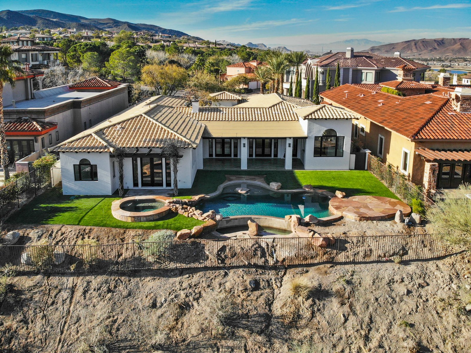
In a market as competitive as Las Vegas real estate, every advantage matters. Drone photography is one of the most effective ways to make your listing stand out, but only when it’s done right.
Why Aerial Photos Matter
Standard ground-level photography shows the interior and a flat view of the exterior. Drone photography adds a dimension that ground shots simply can’t capture:
- Lot size and property boundaries, buyers can see exactly how much land comes with the property
- Neighborhood context, what’s next door, across the street, and down the block
- Proximity to amenities, parks, schools, shopping centers, and major roads
- Property features, pools, RV parking, detached structures, and outdoor living spaces that are invisible from the street
- Views, mountain vistas, city lights, golf course frontage
The Las Vegas Drone Challenge
Las Vegas presents unique challenges for aerial photography. The city is surrounded by airports, McCarran (Harry Reid), Nellis Air Force Base, and Henderson Executive, which means large portions of the valley are in controlled airspace.
As an FAA Part 107 certified remote pilot, I know exactly where I can and can’t fly. I obtain LAANC authorization before every shoot, ensuring every flight is legal and safe. Roughly 20% of the valley has flight restrictions, but that still leaves 80% available for stunning aerial work.
What Makes a Great Drone Shot
Not all drone photos are created equal. Here’s what separates professional aerial photography from amateur shots:
Altitude matters. Too low and you’re just taking elevated ground photos. Too high and the property becomes a dot. The sweet spot is usually 40-80 feet, depending on the lot size.
Time of day is critical. Golden hour, the hour after sunrise or before sunset, produces warm, dramatic lighting that makes properties look their best. Midday sun creates harsh shadows and washed-out colors.
Composition still applies. The rule of thirds, leading lines, and framing aren’t just for ground photography. A well-composed aerial shot guides the viewer’s eye to the property.
Multiple angles. One drone photo isn’t enough. I typically capture 8-12 different angles and altitudes to give the listing a complete aerial story.
Drone + HDR: The Complete Package
Drone photography works best when combined with professional HDR interior and exterior photography. The drone shots establish the property’s context and setting, while the HDR photos showcase the interior. Together, they give buyers a complete picture before they ever schedule a showing.
What to Check Before Ordering
Before booking a drone shoot, check with your HOA. Some communities restrict drone takeoff and landing on common grounds. Gated communities are usually fine since the streets are HOA-maintained, but it’s always best to confirm.
Also consider letting your neighbors know, a drone flying around can attract attention, and explaining the difference between a real estate drone and a surveillance drone can prevent misunderstandings.
Book Your Drone Shoot
Ready to add aerial photography to your Las Vegas listing? Contact me for FAA-certified drone photography with fast turnaround and competitive pricing.
See drone photography packages and pricing, FAA-certified flights across Las Vegas, Henderson and the surrounding valley.

Comments
Loading comments…